
Thank you for supporting this site ❤️
Make a donation
Make a donation
Maison topographic map
Click on the map to display elevation.
Thank you for supporting this site ❤️
Make a donation
Make a donation
About this map
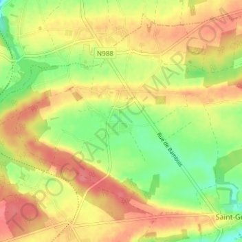
Name: Maison topographic map, elevation, terrain.
Location: Maison, Saint-Gérard, Mettet, Namur, Wallonie, Belgique (50.34218 4.68933 50.38218 4.72933)
Average elevation: 247 m
Minimum elevation: 210 m
Maximum elevation: 276 m
Thank you for supporting this site ❤️
Make a donation
Make a donation
Other topographic maps
Click on a map to view its topography, its elevation and its terrain.