
Thank you for supporting this site ❤️
Make a donation
Make a donation
Biscainho topographic map
Click on the map to display elevation.
Thank you for supporting this site ❤️
Make a donation
Make a donation
About this map
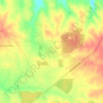
Name: Biscainho topographic map, elevation, terrain.
Location: Biscainho, Coruche, Santarém, Portugal (38.89041 -8.66395 38.93041 -8.62395)
Average elevation: 55 m
Minimum elevation: 16 m
Maximum elevation: 78 m
Thank you for supporting this site ❤️
Make a donation
Make a donation
Other topographic maps
Click on a map to view its topography, its elevation and its terrain.