
Thank you for supporting this site ❤️
Make a donation
Make a donation
Blokker topographic map
Click on the map to display elevation.
Thank you for supporting this site ❤️
Make a donation
Make a donation
About this map
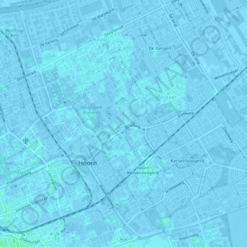
Name: Blokker topographic map, elevation, terrain.
Location: Blokker, Hoorn, Noord-Holland, Nederland (52.64598 5.06872 52.67042 5.11708)
Average elevation: 0 m
Minimum elevation: -3 m
Maximum elevation: 3 m
Thank you for supporting this site ❤️
Make a donation
Make a donation
Other topographic maps
Click on a map to view its topography, its elevation and its terrain.
Munnickaij
Nederland > Noord-Holland > Hoorn > Munnickaij
De naam 'Kaij' verwijst naar de op hoogte gelegen plaats. Mogelijk betreft hier een klooster of een hofstede is gelegen. 'Munnick' kan daarop duiden, als zijnde de hoge plaats van de monniken. Echter 'Munnick' kan ook verwijzen naar Oud Friese woord 'Munnek' dat op mest duidt. Met name voor de plaats in…
Average elevation: 0 m