
Thank you for supporting this site ❤️
Make a donation
Make a donation
Ouled Sellam topographic map
Click on the map to display elevation.
Thank you for supporting this site ❤️
Make a donation
Make a donation
About this map
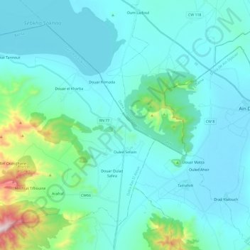
Name: Ouled Sellam topographic map, elevation, terrain.
Location: Ouled Sellam, Ras El Aïoun district, Batna, Algeria (35.77090 5.67919 35.92275 5.91164)
Average elevation: 974 m
Minimum elevation: 864 m
Maximum elevation: 1,722 m
Thank you for supporting this site ❤️
Make a donation
Make a donation
Other topographic maps
Click on a map to view its topography, its elevation and its terrain.