
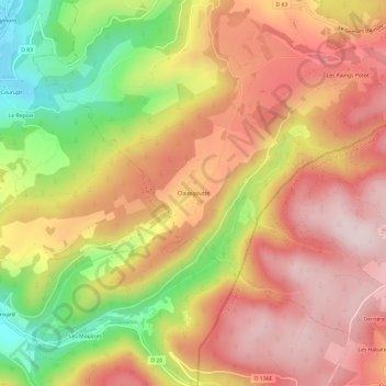
Clairegoutte topographic map
Interactive map
Click on the map to display elevation.
About this map
Name: Clairegoutte topographic map, elevation, terrain.
Average elevation: 628 m
Minimum elevation: 399 m
Maximum elevation: 785 m
Other topographic maps
Click on a map to view its topography, its elevation and its terrain.
La Vigotte
France > Grand Est > Vosges > Girmont-Val-d'Ajol
La Vigotte, Girmont-Val-d'Ajol, Épinal, Vosges, Grand Est, France métropolitaine, 88340, France
Average elevation: 643 m
Étang du Dié
France > Grand Est > Vosges > Girmont-Val-d'Ajol > Les Faings Potot
Étang du Dié, Les Faings Potot, Girmont-Val-d'Ajol, Épinal, Vosges, Grand Est, France métropolitaine, 88340, France
Average elevation: 703 m