
Thank you for supporting this site ❤️
Make a donation
Make a donation
Oak Level topographic map
Click on the map to display elevation.
Thank you for supporting this site ❤️
Make a donation
Make a donation
About this map
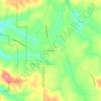
Name: Oak Level topographic map, elevation, terrain.
Location: Oak Level, Cleburne County, Alabama, United States (33.82955 -85.49801 33.86955 -85.45801)
Average elevation: 308 m
Minimum elevation: 261 m
Maximum elevation: 369 m
Thank you for supporting this site ❤️
Make a donation
Make a donation