
Make a donation
Gstaad topographic map
Click on the map to display elevation.
Make a donation
Gstaad
Long known for its walking and hiking trails of varying degrees of difficulty, the mountain air and ambiance attract guests year-round from around the world. Gstaad is also known for its ski and cross-country slopes and winter hiking trails. Glacier 3000 is a major attraction, offering guaranteed snow from December to March and unique high-altitude experiences, including the world’s first summit-to-summit suspension footbridge with views of the Matterhorn and Mont Blanc. Gstaad also offers distinctive culinary experiences, such as the ‘Fondueland Gstaad,’ where visitors can enjoy fondue in oversized outdoor caquelon pots set amidst scenic Alpine landscapes. To facilitate this, fondue backpacks contain all the necessary ingredients and equipment that can be rented from local dairies, allowing for a dining experience in nature.
Make a donation
About this map
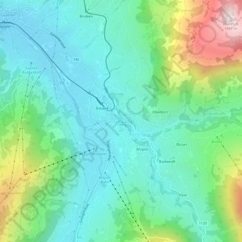
Name: Gstaad topographic map, elevation, terrain.
Average elevation: 1,245 m
Minimum elevation: 1,010 m
Maximum elevation: 1,922 m
Make a donation
Other topographic maps
Click on a map to view its topography, its elevation and its terrain.
Boltigen
Switzerland > Bern > Obersimmental-Saanen administrative district
The municipality includes the cooperative farms (Bäuerten) of Boltigen, Adlemsried, Eschi, Oberbäuert (which includes Littisbach and Unterbächen), Reidenbach, Schwarzenmatt, Simmenegg and Weissenbach. The area includes the valley floor around the Simme River, both sides of the valley and the surrounding…
Average elevation: 1,459 m