
Lesser Poland Voivodeship topographic map
Interactive map
Click on the map to display elevation.
About this map
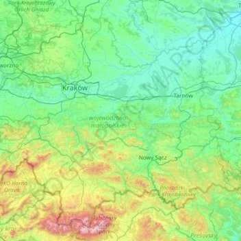
Name: Lesser Poland Voivodeship topographic map, elevation, terrain.
Location: Lesser Poland Voivodeship, Poland (49.17848 19.08312 50.52050 21.42174)
Average elevation: 450 m
Minimum elevation: 149 m
Maximum elevation: 2,591 m
Other topographic maps
Click on a map to view its topography, its elevation and its terrain.