
Cagayan topographic map
Interactive map
Click on the map to display elevation.
Cagayan
The eastern coast forms the northern portion of the Sierra Madre mountain range, while the western limits are generally hilly to low in elevation. The central area, dominated by a large valley, forms the lower basin of the country's longest river, the Cagayan. The mouth is located at the northern town of Aparri.
About this map
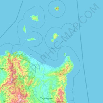
Name: Cagayan topographic map, elevation, terrain.
Location: Cagayan, Cagayan Valley, Philippines (17.51038 120.93181 19.70082 122.47812)
Average elevation: 110 m
Minimum elevation: -2 m
Maximum elevation: 2,238 m