
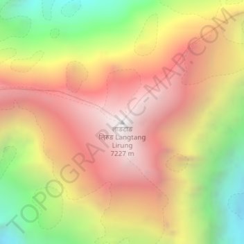
लाङटाङ लिरुङ Langtang Lirung topographic map
Interactive map
Click on the map to display elevation.
About this map
Name: लाङटाङ लिरुङ Langtang Lirung topographic map, elevation, terrain.
Average elevation: 6,228 m
Minimum elevation: 5,032 m
Maximum elevation: 7,193 m
Other topographic maps
Click on a map to view its topography, its elevation and its terrain.
Langtang Ri
Nepal > मध्यमाञ्चल विकास क्षेत्र > Lantan
Langtang Ri, Lantan, रसुवा, बागमती अञ्चल, मध्यमाञ्चल विकास क्षेत्र, Nepal
Average elevation: 6,251 m