
Rimpfischhorn topographic map
Interactive map
Click on the map to display elevation.
About this map
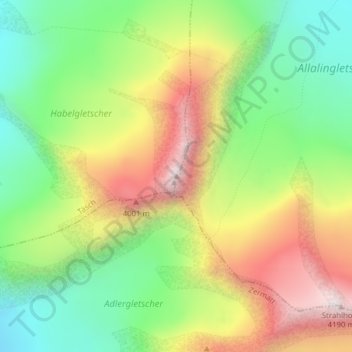
Name: Rimpfischhorn topographic map, elevation, terrain.
Location: Rimpfischhorn, Täsch, Visp, Wallis, 3929, Schweiz (46.02308 7.88391 46.02318 7.88401)
Average elevation: 3,630 m
Minimum elevation: 3,209 m
Maximum elevation: 4,182 m
Other topographic maps
Click on a map to view its topography, its elevation and its terrain.