
Thank you for supporting this site ❤️
Make a donation
Make a donation
Castelo topographic map
Click on the map to display elevation.
Thank you for supporting this site ❤️
Make a donation
Make a donation
About this map
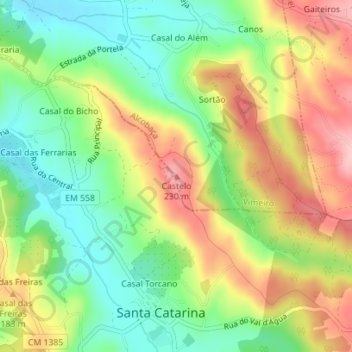
Name: Castelo topographic map, elevation, terrain.
Location: Castelo, Alcobaça, Leiria, 2460-760, Portugal (39.45733 -9.01403 39.45743 -9.01393)
Average elevation: 134 m
Minimum elevation: 56 m
Maximum elevation: 233 m
Thank you for supporting this site ❤️
Make a donation
Make a donation
Other topographic maps
Click on a map to view its topography, its elevation and its terrain.