
Thank you for supporting this site ❤️
Make a donation
Make a donation
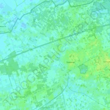
Stekene topographic map
Click on the map to display elevation.
Thank you for supporting this site ❤️
Make a donation
Make a donation
Stekene
Stekene ligt in het Waasland en in Zandig Vlaanderen. Het gebied is rijk aan bos. De gemeente ligt pal ten zuiden van de Belgisch-Nederlandse grens en de hoogte bedraagt 5-7 meter, met stuifzandruggen tot 10 meter hoogte.
Thank you for supporting this site ❤️
Make a donation
Make a donation
About this map
Name: Stekene topographic map, elevation, terrain.
Location: Stekene, Sint-Niklaas, Oost-Vlaanderen, Vlaanderen, 9190, België (51.17598 3.97773 51.24568 4.06988)
Average elevation: 4 m
Minimum elevation: -2 m
Maximum elevation: 12 m
Thank you for supporting this site ❤️
Make a donation
Make a donation
Other topographic maps
Click on a map to view its topography, its elevation and its terrain.