
Thank you for supporting this site ❤️
Make a donation
Make a donation
Paris topographic map
Click on the map to display elevation.
Thank you for supporting this site ❤️
Make a donation
Make a donation
About this map
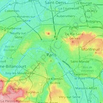
Name: Paris topographic map, elevation, terrain.
Location: Paris, Ile-de-France, Metropolitan France, France (48.81558 2.22412 48.90216 2.46976)
Average elevation: 59 m
Minimum elevation: 21 m
Maximum elevation: 187 m
Thank you for supporting this site ❤️
Make a donation
Make a donation