
Bannmühle topographic map
Interactive map
Click on the map to display elevation.
About this map
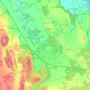
Name: Bannmühle topographic map, elevation, terrain.
Average elevation: 429 m
Minimum elevation: 377 m
Maximum elevation: 492 m
Other topographic maps
Click on a map to view its topography, its elevation and its terrain.
Längersöd
Deutschland > Bayern > Landkreis Traunstein > Kirchanschöring
Längersöd, Kirchanschöring, Landkreis Traunstein, Bayern, 83417, Deutschland
Average elevation: 445 m