
Thank you for supporting this site ❤️
Make a donation
Make a donation
Spring Valley topographic map
Click on the map to display elevation.
Thank you for supporting this site ❤️
Make a donation
Make a donation
About this map
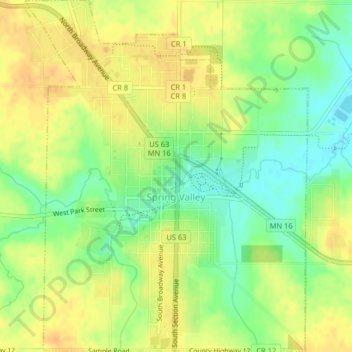
Name: Spring Valley topographic map, elevation, terrain.
Location: Spring Valley, Fillmore County, Minnesota, United States (43.67420 -92.40659 43.70331 -92.37415)
Average elevation: 400 m
Minimum elevation: 381 m
Maximum elevation: 413 m
Thank you for supporting this site ❤️
Make a donation
Make a donation
Other topographic maps
Click on a map to view its topography, its elevation and its terrain.