
Thank you for supporting this site ❤️
Make a donation
Make a donation
West Burke topographic map
Click on the map to display elevation.
Thank you for supporting this site ❤️
Make a donation
Make a donation
About this map
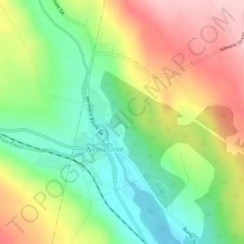
Name: West Burke topographic map, elevation, terrain.
Location: West Burke, Burke, Caledonia County, Vermont, United States (44.63579 -71.98598 44.65327 -71.96840)
Average elevation: 345 m
Minimum elevation: 257 m
Maximum elevation: 455 m
Thank you for supporting this site ❤️
Make a donation
Make a donation
Other topographic maps
Click on a map to view its topography, its elevation and its terrain.