
Thank you for supporting this site ❤️
Make a donation
Make a donation
Clayton County topographic map
Click on the map to display elevation.
Thank you for supporting this site ❤️
Make a donation
Make a donation
About this map
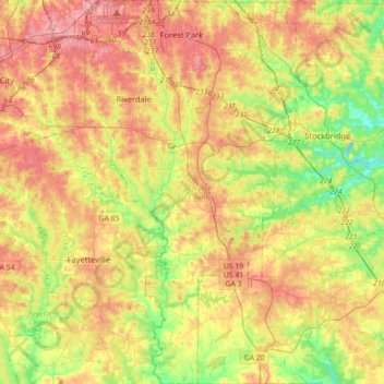
Name: Clayton County topographic map, elevation, terrain.
Location: Clayton County, Georgia, United States (33.35247 -84.45853 33.64885 -84.24386)
Average elevation: 265 m
Minimum elevation: 207 m
Maximum elevation: 326 m
Thank you for supporting this site ❤️
Make a donation
Make a donation
Other topographic maps
Click on a map to view its topography, its elevation and its terrain.