
Rominha topographic map
Interactive map
Click on the map to display elevation.
About this map
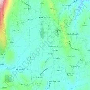
Name: Rominha topographic map, elevation, terrain.
Location: Rominha, Alvaiázere, Leiria, 3250-108, Portugal (39.79235 -8.40170 39.83235 -8.36170)
Average elevation: 312 m
Minimum elevation: 236 m
Maximum elevation: 593 m
Other topographic maps
Click on a map to view its topography, its elevation and its terrain.
Seiceira
Portugal > Leiria > Alvaiázere
Seiceira, Alvaiázere, Leiria, 3250-126, Portugal
Average elevation: 302 m