
Vodecée topographic map
Interactive map
Click on the map to display elevation.
About this map
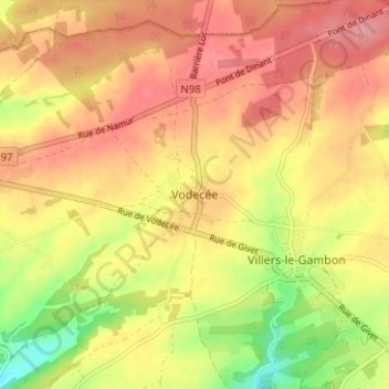
Name: Vodecée topographic map, elevation, terrain.
Location: Vodecée, Philippeville, Namur, Wallonie, 5600, Belgique (50.17720 4.57208 50.21720 4.61208)
Average elevation: 275 m
Minimum elevation: 213 m
Maximum elevation: 315 m
Other topographic maps
Click on a map to view its topography, its elevation and its terrain.
Merlemont
Belgique > Namur > Philippeville > Philippeville
Merlemont, Philippeville, Namur, Wallonie, 5600, Belgique
Average elevation: 229 m