
Waiakoa topographic map
Interactive map
Click on the map to display elevation.
About this map
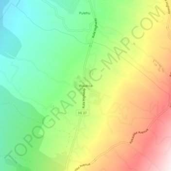
Name: Waiakoa topographic map, elevation, terrain.
Location: Waiakoa, Maui County, Hawaii, 96790, United States (20.73964 -156.34838 20.77964 -156.30838)
Average elevation: 857 m
Minimum elevation: 539 m
Maximum elevation: 1,300 m