
Bushbuckridge topographic map
Interactive map
Click on the map to display elevation.
About this map
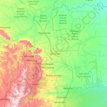
Name: Bushbuckridge topographic map, elevation, terrain.
Location: Bushbuckridge, Ehlanzeni, Mpumalanga, South Africa (-25.18740 30.79504 -23.98124 32.03372)
Average elevation: 681 m
Minimum elevation: 191 m
Maximum elevation: 2,231 m