
Thank you for supporting this site ❤️
Make a donation
Make a donation
Talbot County topographic map
Click on the map to display elevation.
Thank you for supporting this site ❤️
Make a donation
Make a donation
About this map
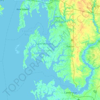
Name: Talbot County topographic map, elevation, terrain.
Location: Talbot County, Maryland, United States (38.57057 -76.45985 38.94503 -75.89596)
Average elevation: 5 m
Minimum elevation: -3 m
Maximum elevation: 33 m
Thank you for supporting this site ❤️
Make a donation
Make a donation