
Thank you for supporting this site ❤️
Make a donation
Make a donation
Ubrique topographic map
Click on the map to display elevation.
Thank you for supporting this site ❤️
Make a donation
Make a donation
About this map
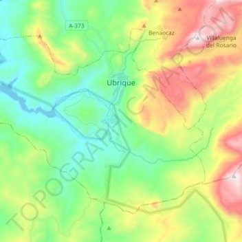
Name: Ubrique topographic map, elevation, terrain.
Location: Ubrique, Sierra de Cádiz, Cádiz, Andalusia, 11600, Spain (36.61417 -5.53982 36.70259 -5.39581)
Average elevation: 612 m
Minimum elevation: 205 m
Maximum elevation: 1,384 m
Thank you for supporting this site ❤️
Make a donation
Make a donation
Other topographic maps
Click on a map to view its topography, its elevation and its terrain.