Geolocate

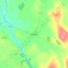
Pollerton Little topographic map

Click on the map to display elevation.

About this map

Name: Pollerton Little topographic map, elevation, terrain.

Location: Pollerton Little, Carlow Rural ED, The Municipal District of Carlow, County Carlow, Leinster, Ireland (52.84619 -6.90526 52.85690 -6.87496)

Average elevation: 73 m

Minimum elevation: 54 m

Maximum elevation: 101 m

Other topographic maps

Click on a map to view its topography, its elevation and its terrain.

Greenoge

Ireland > County Carlow

Average elevation: 272 m

Slievebawn

Ireland > County Carlow

Average elevation: 315 m

Tinryland

Ireland > County Carlow

Average elevation: 72 m

Ardattin

Ireland > County Carlow

Average elevation: 83 m

Blackstairs Mountain

Ireland > County Carlow

Average elevation: 429 m

Borris

Ireland > County Carlow

Average elevation: 60 m

Coolnamara Cross Roads

Ireland > County Carlow

Average elevation: 65 m

Borris

Ireland > County Carlow

Average elevation: 60 m