
Thank you for supporting this site ❤️
Make a donation
Make a donation
Ponta Grossa topographic map
Click on the map to display elevation.
Thank you for supporting this site ❤️
Make a donation
Make a donation
Ponta Grossa
Ponta Grossa was founded on the farm of Miguel da Rocha Ferreira Carvalhaes who chose it as favorable agricultural land. The farm still exists towards Castro. In 1871 the city came to be called Pitangui, but the following year it resumed its original name. Sometimes it is the target of malicious humor due to what its name can send like in Portuguese. One way or another describes the characteristics of the vegetation and the regional topography.
Thank you for supporting this site ❤️
Make a donation
Make a donation
About this map
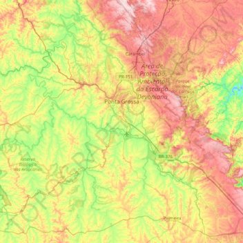
Name: Ponta Grossa topographic map, elevation, terrain.
Average elevation: 893 m
Minimum elevation: 664 m
Maximum elevation: 1,215 m
Thank you for supporting this site ❤️
Make a donation
Make a donation