
Thank you for supporting this site ❤️
Make a donation
Make a donation
Lumpkin topographic map
Click on the map to display elevation.
Thank you for supporting this site ❤️
Make a donation
Make a donation
About this map
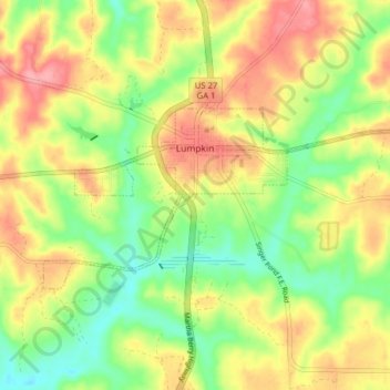
Name: Lumpkin topographic map, elevation, terrain.
Location: Lumpkin, Stewart County, Georgia, United States (32.02680 -84.82972 32.05909 -84.75103)
Average elevation: 147 m
Minimum elevation: 102 m
Maximum elevation: 194 m
Thank you for supporting this site ❤️
Make a donation
Make a donation
Other topographic maps
Click on a map to view its topography, its elevation and its terrain.