
Garcelles-Secqueville topographic map
Interactive map
Click on the map to display elevation.
About this map
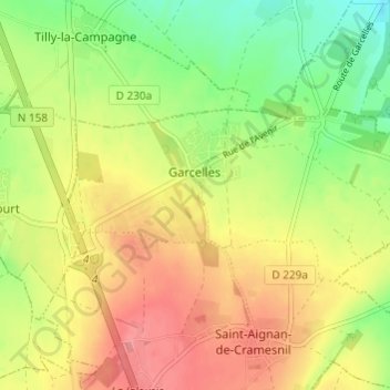
Name: Garcelles-Secqueville topographic map, elevation, terrain.
Average elevation: 83 m
Minimum elevation: 43 m
Maximum elevation: 121 m
Other topographic maps
Click on a map to view its topography, its elevation and its terrain.
Secqueville
France > Normandie > Calvados > Le Castelet > Garcelles-Secqueville
Secqueville, Garcelles-Secqueville, Le Castelet, Caen, Calvados, Normandie, France métropolitaine, 14540, France
Average elevation: 65 m