
Gautouil topographic map
Interactive map
Click on the map to display elevation.
About this map
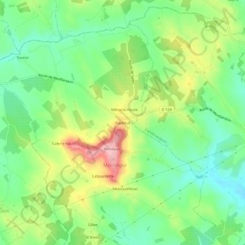
Name: Gautouil topographic map, elevation, terrain.
Average elevation: 141 m
Minimum elevation: 82 m
Maximum elevation: 237 m
Other topographic maps
Click on a map to view its topography, its elevation and its terrain.
Labourdette
France > Nouvelle-Aquitaine > Lot-et-Garonne > Monségur > Labourdette
Labourdette, Monségur, Villeneuve-sur-Lot, Lot-et-Garonne, Nouvelle-Aquitaine, France métropolitaine, 47150, France
Average elevation: 138 m