
Tereñes topographic map
Interactive map
Click on the map to display elevation.
About this map
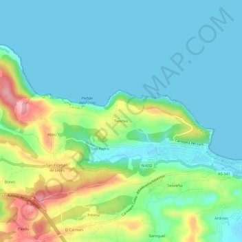
Name: Tereñes topographic map, elevation, terrain.
Location: Tereñes, Ribadesella, Asturias, 33560, España (43.45201 -5.11615 43.49201 -5.07615)
Average elevation: 41 m
Minimum elevation: -2 m
Maximum elevation: 158 m