
Thank you for supporting this site ❤️
Make a donation
Make a donation
Gorgora topographic map
Click on the map to display elevation.
Thank you for supporting this site ❤️
Make a donation
Make a donation
About this map
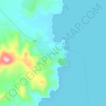
Name: Gorgora topographic map, elevation, terrain.
Location: Gorgora, North Gondar, Amhara Region, Ethiopia (12.21827 37.27714 12.25827 37.31714)
Average elevation: 1,819 m
Minimum elevation: 1,781 m
Maximum elevation: 2,025 m
Thank you for supporting this site ❤️
Make a donation
Make a donation