
Rochefort topographic map
Interactive map
Click on the map to display elevation.
About this map
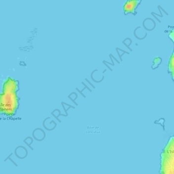
Name: Rochefort topographic map, elevation, terrain.
Average elevation: 1 m
Minimum elevation: 0 m
Maximum elevation: 31 m
Other topographic maps
Click on a map to view its topography, its elevation and its terrain.
Plage du Béchet
France > Bretagne > Saint-Briac-sur-Mer
Plage du Béchet, Rue de la Salinette, Le Tertre Gondan, Saint-Briac-sur-Mer, Saint-Malo, Ille-et-Vilaine, Bretagne, France métropolitaine, 35800, France
Average elevation: 10 m
Île Agot
France > Bretagne > Saint-Briac-sur-Mer
Île Agot, Saint-Briac-sur-Mer, Saint-Malo, Ille-et-Vilaine, Bretagne, France métropolitaine, 35800, France
Average elevation: 1 m