
Thank you for supporting this site ❤️
Make a donation
Make a donation
Zigui County topographic map
Click on the map to display elevation.
Thank you for supporting this site ❤️
Make a donation
Make a donation
About this map
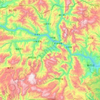
Name: Zigui County topographic map, elevation, terrain.
Location: Zigui County, Yichang, Hubei, China (30.63885 110.31869 31.18931 110.99373)
Average elevation: 862 m
Minimum elevation: 59 m
Maximum elevation: 2,027 m
Thank you for supporting this site ❤️
Make a donation
Make a donation
Other topographic maps
Click on a map to view its topography, its elevation and its terrain.