
Thank you for supporting this site ❤️
Make a donation
Make a donation
Zernez topographic map
Click on the map to display elevation.
Thank you for supporting this site ❤️
Make a donation
Make a donation
Zernez
Lai da Ova Spin is a compensation reservoir on the river Spöl. It is located in the upper areas of the Lower Engadine valley (Romansh: Engiadina Bassa). It is located at an elevation of 1,473 m (4,833 ft) and is connected to the railway network of the Rhätische Bahn. In Zernez, the stream Spöl empties into the Inn (Romansh: En).
Thank you for supporting this site ❤️
Make a donation
Make a donation
About this map
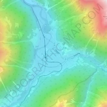
Name: Zernez topographic map, elevation, terrain.
Average elevation: 1,789 m
Minimum elevation: 1,447 m
Maximum elevation: 2,752 m
Thank you for supporting this site ❤️
Make a donation
Make a donation