
Thank you for supporting this site ❤️
Make a donation
Make a donation
Austin topographic map
Click on the map to display elevation.
Thank you for supporting this site ❤️
Make a donation
Make a donation
About this map
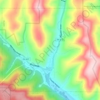
Name: Austin topographic map, elevation, terrain.
Location: Austin, Potter County, Pennsylvania, United States (41.62378 -78.11167 41.65061 -78.06889)
Average elevation: 540 m
Minimum elevation: 397 m
Maximum elevation: 696 m
Thank you for supporting this site ❤️
Make a donation
Make a donation
Other topographic maps
Click on a map to view its topography, its elevation and its terrain.