
De Kiel topographic map
Interactive map
Click on the map to display elevation.
About this map
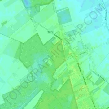
Name: De Kiel topographic map, elevation, terrain.
Location: De Kiel, Coevorden, Drenthe, Nederland (52.84765 6.71456 52.87869 6.75446)
Average elevation: 19 m
Minimum elevation: 14 m
Maximum elevation: 25 m
Other topographic maps
Click on a map to view its topography, its elevation and its terrain.
Veenhuizen
Nederland > Drenthe > Coevorden > Dalen
Veenhuizen, Dalen, Coevorden, Drenthe, Nederland, 7751 SR, Nederland
Average elevation: 12 m
Oosterhesselen
Nederland > Drenthe > Coevorden
Oosterhesselen, Coevorden, Drenthe, Nederland
Average elevation: 15 m
Noord-Sleen
Nederland > Drenthe > Coevorden
Noord-Sleen, Coevorden, Drenthe, Nederland
Average elevation: 18 m
Schoonoord
Nederland > Drenthe > Coevorden
Schoonoord, Coevorden, Drenthe, Nederland
Average elevation: 19 m
't Haantje
Nederland > Drenthe > Coevorden
't Haantje, Coevorden, Drenthe, Nederland
Average elevation: 18 m
Wezuperbrug
Nederland > Drenthe > Coevorden
Wezuperbrug, Coevorden, Drenthe, Nederland
Average elevation: 20 m
De Klencke
Nederland > Drenthe > Coevorden
De Klencke, Klenkerweg, Oosterhesselen, Coevorden, Drenthe, Nederland, 7861TC, Nederland
Average elevation: 15 m