
La Chapelle-en-Valgaudémar topographic map
Interactive map
Click on the map to display elevation.
About this map
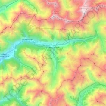
Name: La Chapelle-en-Valgaudémar topographic map, elevation, terrain.
Average elevation: 2,104 m
Minimum elevation: 929 m
Maximum elevation: 3,585 m