
Tazrourt topographic map
Interactive map
Click on the map to display elevation.
About this map
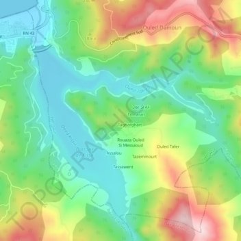
Name: Tazrourt topographic map, elevation, terrain.
Location: Tazrourt, Jijel, Daïra Jijel, Jijel, 18005, Algérie (36.75996 5.67540 36.79996 5.71540)
Average elevation: 124 m
Minimum elevation: -1 m
Maximum elevation: 337 m
Other topographic maps
Click on a map to view its topography, its elevation and its terrain.
Oued Kissir
Algérie > Jijel > Daïra Jijel > Jijel
Oued Kissir, Jijel, Daïra Jijel, Jijel, 18005, Algérie
Average elevation: 54 m
Ouled Bounar
Algérie > Jijel > Daïra Jijel > Jijel
Ouled Bounar, Jijel, Daïra Jijel, Jijel, 18049, Algérie
Average elevation: 62 m