
Les Écacheries topographic map
Interactive map
Click on the map to display elevation.
About this map
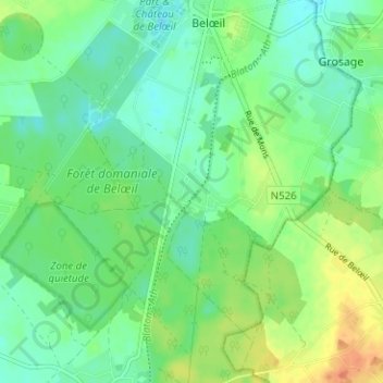
Name: Les Écacheries topographic map, elevation, terrain.
Location: Les Écacheries, Belœil, Ath, Hainaut, Wallonie, 7970, Belgique (50.51082 3.71264 50.55082 3.75264)
Average elevation: 63 m
Minimum elevation: 49 m
Maximum elevation: 89 m