
Harkerode topographic map
Interactive map
Click on the map to display elevation.
About this map
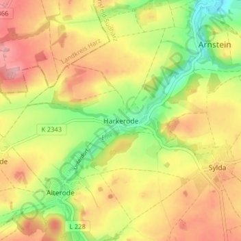
Name: Harkerode topographic map, elevation, terrain.
Location: Harkerode, Mansfelder Land, Sachsen-Anhalt, 06456, Deutschland (51.66603 11.37947 51.70603 11.41947)
Average elevation: 214 m
Minimum elevation: 147 m
Maximum elevation: 273 m