
Grandrieu topographic map
Interactive map
Click on the map to display elevation.
About this map
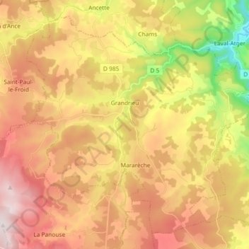
Name: Grandrieu topographic map, elevation, terrain.
Average elevation: 1,198 m
Minimum elevation: 837 m
Maximum elevation: 1,501 m
Other topographic maps
Click on a map to view its topography, its elevation and its terrain.
Saint-Chély-d'Apcher
Saint-Chély-d'Apcher, Mende, Lozère, Occitanie, France métropolitaine, 48200, France
Average elevation: 1,032 m