
Hondelage topographic map
Interactive map
Click on the map to display elevation.
About this map
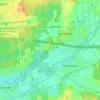
Name: Hondelage topographic map, elevation, terrain.
Average elevation: 80 m
Minimum elevation: 68 m
Maximum elevation: 100 m
Other topographic maps
Click on a map to view its topography, its elevation and its terrain.
Querumer Forst
Deutschland > Niedersachsen > Braunschweig > Sydikum
Querumer Forst, Wabe-Schunter-Beberbach, Sydikum, Braunschweig, Niedersachsen, 38108, Deutschland
Average elevation: 79 m