
Ngada topographic map
Interactive map
Click on the map to display elevation.
About this map
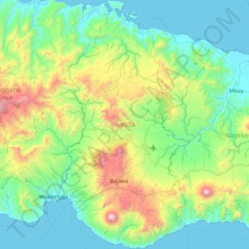
Name: Ngada topographic map, elevation, terrain.
Location: Ngada, Ost-Nusa Tenggara, Indonesien (-8.95658 120.81074 -8.34342 121.18434)
Average elevation: 469 m
Minimum elevation: -1 m
Maximum elevation: 2,196 m