
东关上村 topographic map
Interactive map
Click on the map to display elevation.
About this map
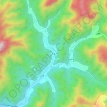
Name: 东关上村 topographic map, elevation, terrain.
Location: 东关上村, 房山区, 北京市, 中国 (39.63359 115.71425 39.67359 115.75425)
Average elevation: 440 m
Minimum elevation: 173 m
Maximum elevation: 930 m