
Alta Vista topographic map
Interactive map
Click on the map to display elevation.
About this map
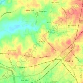
Name: Alta Vista topographic map, elevation, terrain.
Average elevation: 235 m
Minimum elevation: 200 m
Maximum elevation: 261 m
Other topographic maps
Click on a map to view its topography, its elevation and its terrain.
Mount Jefferson
United States > Alabama > Lee County > Opelika
Mount Jefferson, Opelika, Lee County, Alabama, United States
Average elevation: 234 m
Oak Dale
United States > Alabama > Lee County > Opelika
Oak Dale, Opelika, Lee County, Alabama, 36801, United States
Average elevation: 238 m