
Hải Lăng District topographic map
Interactive map
Click on the map to display elevation.
About this map
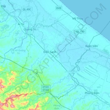
Name: Hải Lăng District topographic map, elevation, terrain.
Location: Hải Lăng District, Quang Tri province, Vietnam (16.56588 107.07834 16.80243 107.38899)
Average elevation: 28 m
Minimum elevation: -2 m
Maximum elevation: 425 m