
朴头镇 topographic map
Interactive map
Click on the map to display elevation.
About this map
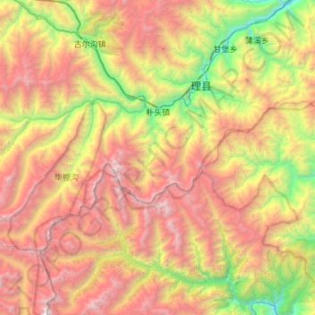
Name: 朴头镇 topographic map, elevation, terrain.
Location: 朴头镇, 理县, 阿坝藏族羌族自治州, 四川省, 中国 (31.19735 102.69051 31.46931 103.22511)
Average elevation: 3,600 m
Minimum elevation: 1,581 m
Maximum elevation: 6,087 m
Other topographic maps
Click on a map to view its topography, its elevation and its terrain.