
Thank you for supporting this site ❤️
Make a donation
Make a donation
Tubaral topographic map
Click on the map to display elevation.
Thank you for supporting this site ❤️
Make a donation
Make a donation
About this map
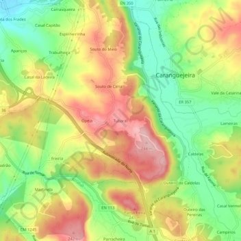
Name: Tubaral topographic map, elevation, terrain.
Location: Tubaral, Caranguejeira, Leiria, 2420-091, Portugal (39.71612 -8.74031 39.75612 -8.70031)
Average elevation: 155 m
Minimum elevation: 69 m
Maximum elevation: 243 m
Thank you for supporting this site ❤️
Make a donation
Make a donation