
Tamrabet topographic map
Interactive map
Click on the map to display elevation.
About this map
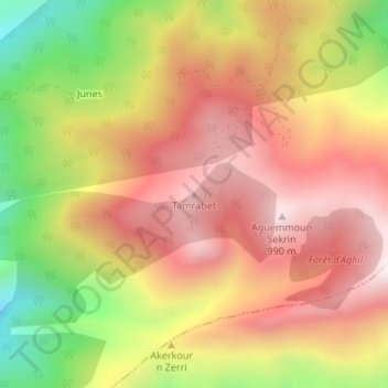
Name: Tamrabet topographic map, elevation, terrain.
Location: Tamrabet, Melbou, Daïra Souk El-Ténine, Béjaïa, 06012, Algérie (36.60738 5.40084 36.60748 5.40094)
Average elevation: 631 m
Minimum elevation: 146 m
Maximum elevation: 982 m