
Quiroga topographic map
Interactive map
Click on the map to display elevation.
About this map
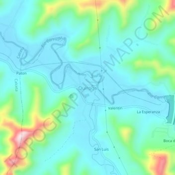
Name: Quiroga topographic map, elevation, terrain.
Location: Quiroga, Parroquia Quiroga, Bolívar, Manabí, Ecuador (-0.90391 -80.11610 -0.86391 -80.07610)
Average elevation: 98 m
Minimum elevation: 21 m
Maximum elevation: 387 m
Other topographic maps
Click on a map to view its topography, its elevation and its terrain.